
The Project
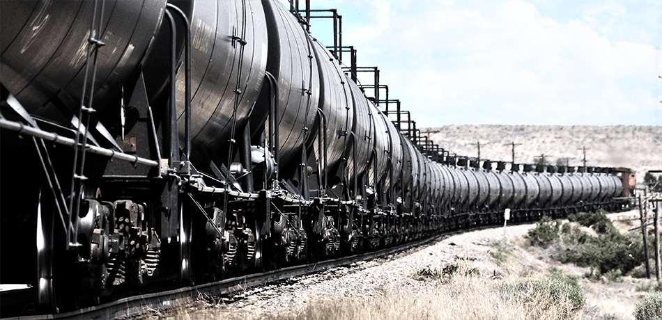
The purpose of the proposed Uinta Basin Railway (UBR) is to connect Uinta Basin fossil fuels companies into the national rail network in order to allow them to access out-of-state and overseas markets. This idea has existed for decades with several past studies already having explored the idea, though it seems the project has never moved forward due to the extreme cost. However, with the oil refineries that process Uinta Basin crude oil in Salt Lake City at capacity, fossil fuel companies and their powerful political allies seem hungrier than ever to push the project forward, no matter the costs.
The Work Being Done
The Utah Permanent Community Impact Fund Board (CIB) has granted $27.9 million of community impact funds to the Seven County Infrastructure Coalition (SCIC) to drive work on the project. This money is being spent on engineering and other studies as well as moving the project through permitting and environmental study processes. The cost of constructing the project has been estimated to be at least $1.2 billion, though actual construction costs could prove to be much higher. Ultimately, this multi-billion dollar project seems to be a financial boondoggle, one which Utah’s elected officials have already gotten the public wrapped up in.
The Consequences
According to a 2018 study commissioned by the SCIC, the UBR would have the capacity to transport up to 350,000 barrels of oil per day. This would represent more than four times what is currently produced in the basin — around 80,000 barrels per day. This could unlock a frenzy of new oil development in the Uinta Basin, which is not possible with current transportation capacity. Between conventional oil reserves and oil shale and tar sands deposits — the world’s most carbon-intensive fuel sources — the basin potentially contains over 100 billion barrels of oil, often being compared favorably to the reserves of Saudi Arabia.
Extracting and combusting these fuels would amount to constructing and detonating a new carbon bomb at a time when the urgency to act on climate change and keep fossil fuels in the ground is more evident than ever. It would also further exacerbate air pollution in the Uinta Basin, which due to oil and gas development, already exceeds federal standards, leading to a public health crisis.
Important Links and Documents
- Project homepage for public involvement in the UBR Environmental Impact Statement (EIS)
- Scoping comments for the EIS are due September 3rd.
- All incoming documents (FD_36284_0) submitted to the Surface Transportation Board
- All outgoing documents (FD_36284_0) submitted to the Surface Transportion Board
- UBR Project Website maintained by the Seven County Infrastructure Coalition
- Petition opposing UBR Indian Canyon and Wells Draw Routes
- Coalition Letter to the CIB regarding UBR and public funding, June 2019
- Factsheet: “Stop the CIB from Squandering Our Public Funds”
News Coverage:
- A New Freight Train Route For Utah? Uinta Basin Hopes So. Amy Joi O’Donoghue. Deseret News. July 18, 2019.
- Feds Looking For Public Input On Uinta Basin Railway Proposed Route Through Moffat County.
Article by Clay Thorp. Craig Daily Press. July 18, 2019. - Panel Shifts Gears On Best Rail Route To Move Oil From Eastern Utah. Article by Brian Maffly. Salt Lake Tribune. May 9, 2019.
- CIB should fund communities, not a dirty energy railroad – Op Ed by @_MaxGranger in the Salt Lake Tribune. December, 2018.
- “Is seven-county coalition squandering money earmarked for rural Utah?” Article by Brian Maffly. Salt Lake Tribune. July 11, 2017.
- Radio Active Segment on the UBR Lara Jones interviewing Ryan Beam of the Center for Biological Diversity and Darrell Fordham of Argyle Wilderness Preservation Alliance. (segment starts at 44:30)

Background:
The Seven County Infrastructure Coalition (SCIC):
The SCIC is the state entity responsible for planning and pushing forward the Uinta Basin Railway, the Book Cliffs Highway, and other large infrastructure projects aimed at increasing fossil fuel production in eastern Utah. The coalition was formed in 2014 and is comprised of seven counties in eastern Utah including: Carbon, Daggett, Duchesne, Emery, San Juan, Sevier, and Uintah. Grand County originally joined the coalition and then pulled out in 2015 over public opposition to the Book Cliffs Highway and the SCIC.
The SCIC and their projects are financed almost entirely through Community Impact Board (CIB) Grants, which would otherwise be available to rural communities to help alleviate the impacts of oil and gas production. This demonstrates a shift in how CIB money is being used in the State of Utah. Rather than being available to support rural communities with fire stations, road work, water projects, and healthcare facilities, this public money is now being granted in much larger sums to build infrastructure that benefits private corporations and promotes the development of oil, gas, tar sands, and oil shale in the state. For example, in December 2018, the SCIC agreed to grant $27.9 million to the SCIC Uinta Rail Line in three phases. The previous maximum grant/loan combination to rural entities for public services was capped at $5 million and rarely totaled that.
The executive director of the SCIC is Mike McKee, you may remember him as a Uintah County Commissioner. He now makes an annual salary of $160,000 that comes directly from CIB funds.
“The coalition is unlike any other entity that comes before this board. That can’t be ignored Mr. McKee. We pay your salary, we pay your administrative expenses entirely. You have no other significant sources of income. We pay your counsel, we pay everything. You’re a child of the CIB board, you’re a child of the state.” CIB Board Member November 2018
SCIC Website: lists current projects
Upcoming Meetings: (every second Thursday of the Month)
Meeting Archives: Notes, packets
The Utah Permanent Community Impact Board (CIB):
The Utah Permanent Community Impact Fund Board (CIB) is the state entity responsible for distributing royalty payments from fossil fuel extraction on federal public lands back to communities that are negatively socially or economically impacted by such extraction. In accordance with the Mineral Leasing Act as well as Utah law, the board is mandated to use the royalty payments for “(i) planning, (ii) construction and maintenance of public facilities, and (iii) provision of public service.” Accordingly, the board typically issues loans and grants to towns, counties, and other political subdivisions of the state for projects like road repairs, firefighting, libraries, and other public facilities.
CIB Website
Meeting Archives: Upcoming meetings (usually the first Thursday of the month). Agenda, notes, packets
Uinta Basin Rail Alternative Routes:
Those proposed alternatives are the Indian Canyon Route, the Craig Route, and the Wells Draw Route, as described in further detail below:
- The Indian Canyon Route would be approximately 80 miles long and would connect an existing rail line owned by Union Pacific Railway Company (UP) near Kyune, Utah to a terminus point in the Uinta Basin near Leland Bench, Utah, approximately 9.5 miles south of Fort Duchesne, Utah. Starting at Leland Bench, this route would proceed westward, past the South Myton Bench area, until intersecting Indian Canyon approximately 2 miles south of Duchesne, Utah. After entering Indian Canyon, the route would turn southwest and follow Indian Creek upstream toward its headwaters below Indian Creek Pass, paralleling U.S. Highway 191 for approximately 21 miles. The Indian Canyon Route would use a summit tunnel to pass through the West Tavaputs Plateau and, after emerging from the tunnel, would descend the Roan Cliffs to reach Emma Park, an open grassy area at the base of the Roan Cliffs. The route would then run westward through Emma Park and connect to the UP Provo Subdivision near the railroad timetable station at Kyune. The route would cross land owned or managed by the State of Utah, the U.S. Forest Service (USFS), the Bureau of Land Management (BLM), and the Ute Indian Tribe. At this time, the Coalition has identified the Indian Canyon Route as its preferred alternative.
- The Craig Route would be approximately 185 miles long and would connect an existing UP rail line near Axial, Colorado, to two terminus points in the Uinta Basin near South Myton Bench (approximately 3.5 miles southwest of Myton, Utah) and Leland Bench, Utah. The lines from those two terminus points would meet at a junction approximately 4 miles north of Leland Bench. From the junction, the Craig Route would proceed generally northward for approximately 7 miles, then turn and proceed generally eastward, crossing the Green River approximately 5 miles south of Jensen, Utah. The route would then proceed southeasterly, entering Colorado approximately 3 miles northwest of Dinosaur, Colorado, and would connect to the Deseret Power Railroad (DPR) south of Dinosaur. The Craig Route would utilize approximately 13 miles of the DPR to proceed eastward and would depart the DPR approximately 2 miles west of the Deserado Mine. It would then proceed generally eastward to connect to the UP Craig Subdivision near the railroad timetable station at Axial. This route would cross land owned or managed by the BLM, the State of Colorado, and the State of Utah. It would not cross USFS or tribal land.
- The Wells Draw Route would be approximately 105 miles long and would connect an existing UP rail line near Kyune, Utah, to two terminus points in the Uinta Basin near South Myton Bench and Leland Bench, Utah. The lines from those two terminus points would meet at a junction approximately 6.5 miles south of South Myton Bench. From the junction, the Wells Draw Route would run southward, generally following Wells Draw toward its headwaters. After reaching the headwaters of Wells Draw, the route would turn westward and enter Argyle Canyon. It would remain on the north wall of Argyle Canyon for approximately 25 miles, eventually reaching the floor of the canyon near the headwaters of Argyle Creek. The route would then enter a summit tunnel through the West Tavaputs Plateau and, after emerging from the tunnel, would descend the Roan Cliffs to reach Emma Park. The route would run westward through Emma Park and connect to the UP Provo Subdivision near the railroad timetable station at Kyune. The Wells Draw Route would cross land owned or managed by the BLM and the State of Utah. It would not cross USFS or tribal land.
Header Photo Credit: Global One Transport, Price River Terminal

